Astoria Fishing Charters
Astoria fishing charters give anglers direct access to the Columbia River mouth, Buoy 10, Youngs Bay, and nearshore Pacific waters holding salmon, sturgeon, bottomfish, and seasonal halibut.
TrustedFish connects anglers with proven local captains in Astoria —no commissions, no pay-to-play listings, no BS. Every charter on our platform is invite-only, vetted for skill, local knowledge, and reputation. If they’re listed, they’ve earned it.
Top Rated Charters in Astoria
Astoria Fishing Guide
Astoria fishing charters operate at the intersection of river, tidal, and open-ocean conditions where water movement, salinity, bait concentration, and tidal exchanges shift fish behavior constantly. The Columbia River mouth is one of the most dynamic fisheries on the West Coast. Salmon may push deep into the river on a single flood tide, then move back toward the ocean when current speed rises. Sturgeon slide between deep slots and channel edges based on salinity and flow. Bottomfish depend on offshore stability. DIY anglers often struggle because productive lanes change fast and require precise boat handling. Guides eliminate uncertainty by reading tide height, current direction, bait schools, and daily water clarity, keeping clients on active fish from the start.
Buoy 10 and river mouth fisheries demand expert positioning. Salmon stack along tide rips, color changes, and depth breaks where bait collects. A small shift in current or wind can turn a quiet stretch into an active zone. Sturgeon rely heavily on bottom composition, flow rate, and scent movement, requiring exact anchor lines and bait placement. Nearshore ocean trips depend on swell height, current direction, and bottom structure. Astoria fishing guides adjust trolling speed, lead length, anchor positions, and drift alignment in real time. This precision allows anglers to target high-value species safely and efficiently in a fast-changing environment.
Popular Fishing Areas
Buoy 10 and Lower Columbia Tidal Zone
Buoy 10 is one of the most productive yet complex salmon fisheries on the West Coast because tide speed, salinity, and water color shift constantly. Salmon enter on flood tide and position along depth contours, tide rips, and the edges of bait schools. When ebb tide accelerates, fish slide lower in the water column and often gather where temperature breaks form near the mouth. Wind interacting with strong outgoing water can create heavy surface chop, pushing salmon into calmer lanes or deeper edges. Guides monitor tide slope, clarity, bait readings, and current seams to run trolling paths that keep lures in the productive part of the column instead of drifting off target.
Youngs Bay and Estuary Channels
Youngs Bay offers protected estuary water where fall Chinook and coho stage before moving upriver. Incoming tide brings cleaner, cooler water that draws salmon toward temperature lines, channel edges, and flats holding anchovies and herring. Outgoing tide spreads fish deeper and distributes bait across the bay, requiring more precise depth control. This zone fishes reliably when the Columbia River mouth becomes rough or when salmon hold offshore and enter in smaller pulses. Guides adjust trolling passes, bait depth, and speed to match how the tide interacts with bottom contours, ensuring baits pass through high-percentage lanes where fish roll, push wakes, or mark consistently on electronics.
Astoria Deep Channels and Sturgeon Slots
Deep channels between Tongue Point, Altoona, and up toward St. Helens create prime sturgeon habitat. These fish respond to a combination of salinity, bottom composition, and flow rate. High river discharge pushes sturgeon into deeper slots and troughs where current softens, while moderate flow allows them to spread along adjacent ledges and shelves. Subtle changes in tide direction alter scent drift, requiring anchor adjustments to place baits directly in feeding lanes. Productive depths shift daily based on runoff, clarity, and pressure. Guides maintain exact anchor positioning, weight selection, and bait presentation to keep offerings stable on bottom where sturgeon track scent movement and forage naturally.
Nearshore Pacific Waters and Offshore Reef Lines (
When ocean conditions allow, Astoria charters run nearshore for lingcod, rockfish, halibut, and ocean salmon. Productivity depends on swell height, current direction, and clarity. Rocky reefs, contour breaks, and underwater ridges concentrate bait, drawing predators into predictable feeding zones. Clear water typically pushes fish deeper, while light turbidity increases shallow feeding activity. Salmon follow temperature gradients and bait schools offshore, then move inward as tides align. Guides use controlled drifts or long trolling passes to match depth, structure, and current direction. They adjust lure speed and angle continuously, accounting for changing swell patterns and tide interaction with the reef edges.
Extended Target Zones
Astoria-Megler Bridge Span
The Astoria-Megler Bridge corridor produces consistent salmon and sturgeon action due to concentrated current flow, strong vertical relief, and deep troughs that funnel fish. Salmon use these lanes during tidal transitions, holding near current seams and mid-depth breaks when bait gathers. Sturgeon position along bottom edges and soft depressions where scent collects as tide speed changes. Wind direction alters surface movement and can shift salmon into shaded or calmer bridge lanes. Guides refine their trolling or anchoring angles to intersect fish travel routes, maintaining lure depth and stability even when current accelerates. This zone performs well when pressure increases at Buoy 10 or when the mouth becomes unsafe.
Tongue Point Flats and Channel Edges
Tongue Point offers a varied mix of shallow flats, mid-depth edges, and soft-bottom channels that serve as staging and feeding areas for salmon and sturgeon. Salmon hold along contour changes where bait collects, especially during incoming tide when cooler, cleaner water pushes upriver. Sturgeon rely heavily on flow rate and bottom type, concentrating in low-current pockets and deeper edges where scent drift pools. Water clarity changes quickly on outgoing tide, shifting where fish suspend or settle on bottom. Guides emphasize maintaining precise lure depth, adjusting trolling speed, and repositioning anchor lines as tide velocity changes. This zone provides steady action when the main river mouth becomes unstable or overly pressured.
Fishing Seasons in Astoria
Spring
Spring concentrates sturgeon in deeper Columbia River channels influenced by snowmelt, runoff, and salinity. Fish position based on flow rate and bottom stability, requiring careful bait placement and exact anchor angles. Salmon begin staging offshore as conditions warm, with some early Chinook entering the lower river on favorable tide cycles. Water temperature rises slowly, influencing bait distribution and tide speed. Clarity changes dramatically after rain, pushing feeding windows into shorter but more predictable periods. Guides rely on scent-driven rigs for sturgeon and controlled, depth-specific trolling for early-season salmon, ensuring presentations hold steady despite shifting current and temperature patterns.
Summer
Summer drives heavy salmon movement along the ocean edge as Chinook and coho track anchovies and herring before entering the Columbia. Nearshore waters stabilize when swell height decreases, improving access to bottomfish on reefs and ledges. Sturgeon shift between deeper river sectors and moderate-flow channels depending on runoff and tide speed. Offshore temperature layers determine salmon depth, requiring guides to adjust lead length, weights, and trolling speed to keep baits in the correct band. Stable weather produces long bite windows near tide rips and color changes, while wind shifts can disrupt clarity and reposition fish quickly.
Fall
Fall marks peak salmon migration as Chinook and coho surge through Buoy 10, Youngs Bay, and upriver travel lanes. Flood tide pushes fish deeper into the river, while ebb tide concentrates them near the mouth. Slight clarity shifts change where salmon travel, often redirecting fish to mid-river edges or deeper shelves. Sturgeon remain active in deeper channels as flow moderates. Guides refine trolling speed and angle to match tide slope, reposition quickly when pressure moves fish, and adjust bait profiles to reflect water color and light penetration. This season provides the most consistent salmon action but demands precise tide timing.
Winter
Winter is dominated by sturgeon fishing as fish hold in deep, slow-moving channels where temperature remains relatively stable. Cold water increases clarity, requiring natural scent presentation and proper weight selection to keep baits stationary in subtle current. Depth varies daily based on flow and salinity. Salmon remain offshore in deep wintering zones, usually inaccessible due to weather. Guides focus on predictable sturgeon travel lanes, adjusting anchor placement, leader length, and bait choice as current changes. Calm weather windows occasionally allow for limited nearshore bottomfish access, but success hinges on reading tide speed, clarity, and bottom contour.
Top Gamefish in Astoria
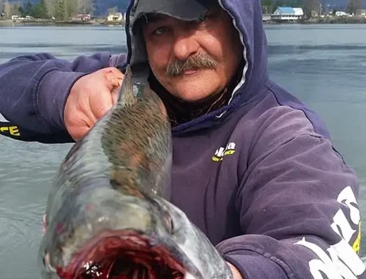
- Chinook Salmon – 10 to 30 lbs Strong, sustained runs and deep power. Hold along tide rips, current seams, and temperature breaks. Peak during fall migration through Buoy 10 and the lower Columbia.
- Coho Salmon – 5 to 12 lbs Fast and aggressive surface-oriented fighters. Track bait along ocean edges and tide lines. Active during late summer and early fall runs.
- White Sturgeon – 20 to 200 lbs Powerful bottom fighters holding in deep channels and slots. Respond to precise bait placement. Productive year-round with strongest action during stable spring and winter flows.
- Lingcod – 8 to 30 lbs Ambush predators on reefs and rocky ledges. Hard initial strike and steady drag-pulling fight. Best during calm nearshore windows.
- Rockfish – 1 to 6 lbs School along reef structure and rocky breaks. Quick bites with steady pull. Depend on stable ocean conditions for consistent action.
- Halibut – 20 to 60 lbs Hold on deep offshore ledges and soft-bottom transitions. Heavy, sustained fights. Available during limited open seasons.
Astoria Fishing FAQs
What species can I catch with Astoria fishing charters?
Chinook, coho, sturgeon, lingcod, rockfish, and seasonal halibut depending on tides and ocean conditions.
Is Buoy 10 difficult to fish without a guide?
Yes. Tides, wind, and heavy current require precise trolling and positioning. Guides ensure safe and productive access.
When is the best time to fish Astoria?
Fall for peak salmon, spring and winter for sturgeon, and summer for bottomfish and ocean salmon.
Are ocean trips weather dependent?
Yes. Nearshore and offshore trips require safe swell and wind conditions. Captains monitor conditions closely.
Do charters supply everything?
Yes. Rods, tackle, bait, safety equipment, and proper gear for river and ocean conditions.